File:Würzburg.jpg

Original file (10,789 × 2,061 pixels, file size: 4.73 MB, MIME type: image/jpeg)
Captions
Captions
| DescriptionWürzburg.jpg |
Français : Panorama de la ville de Würzburg |
||||||
| Date | |||||||
| Source | Own work | ||||||
| Author |
Matthieu Riegler
|
||||||
| Other versions | Derivative works of this file: Würzburg St. Peter und Paul (aus Panorama).jpg |
| Camera location | 49° 47′ 26.94″ N, 9° 55′ 22.19″ E | View this and other nearby images on: OpenStreetMap |
|---|
| Annotations InfoField | This image is annotated: View the annotations at Commons |
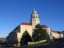
Das älteste Hochhaus Würzburgs von 1929 in der Augustinerstraße. Hier wegen Einsturzgefährdung eingerüstet.
Polizeipräsidium
Fachhochschule
St. Alfons
Gästehaus der Universität
Hexenturm
Reste des Pleindenturms
Turm des Landratsamtes. Hier in auffälligem grün eingerüstet im Rahmen von Dachausbau und -renovierung. Seit 18.5.2010 ist der neue Turm wieder zu sehen.
Die Mainkuh. Liegt inzwischen etwas weiter Stromaufwärts.
Mergentheimer Straße
König-Ludwig-Haus
Congress Centrum Würzburg (CCW)
Schleuse
Hirtenturm
Schneidturm

|
This image has been assessed under the valued image criteria and is considered the most valued image on Commons within the scope: Würzburg. You can see its nomination here. |
File history
Click on a date/time to view the file as it appeared at that time.
| Date/Time | Thumbnail | Dimensions | User | Comment | |
|---|---|---|---|---|---|
| current | 16:08, 6 August 2009 | 10,789 × 2,061 (4.73 MB) | Kyro (talk | contribs) | {{Information |Description=Panorama de la ville de Würzburg |Source= own work |Date=2009-08-05 |Author={{user:Kyro/creditphotoshop}} |Permission= |other_versions= }} Category:Würzburg |
You cannot overwrite this file.
File usage on Commons
The following 8 pages use this file:
File usage on other wikis
The following other wikis use this file:
- Usage on azb.wikipedia.org
- Usage on de.wikipedia.org
- Usage on el.wikipedia.org
- Usage on fr.wikipedia.org
- Usage on incubator.wikimedia.org
- Usage on tr.wikipedia.org
Metadata
This file contains additional information such as Exif metadata which may have been added by the digital camera, scanner, or software program used to create or digitize it. If the file has been modified from its original state, some details such as the timestamp may not fully reflect those of the original file. The timestamp is only as accurate as the clock in the camera, and it may be completely wrong.
| Orientation | Normal |
|---|---|
| Horizontal resolution | 72 dpi |
| Vertical resolution | 72 dpi |
| Software used | Adobe Photoshop CS3 Windows |
| File change date and time | 20:07, 5 August 2009 |
| Color space | sRGB |
- CC-BY-3.0
- Photos by Matthieu Riegler
- Files with derivative versions
- Files with coordinates missing SDC location of creation (49° N, 9°E)
- Images with annotations
- Images with 10+ annotations
- Valued images sorted by promotion date
- Valued images promoted 2010-06
- Valued images missing SDC depicts
- Valued images missing SDC creator
- Valued images of Bavaria
- Pages with maps


.JPG/220px-Franziskaner-Wü_(Front).JPG)